Cimenarum, before the fire: The Map of Cimenarum during the reigns of Vohan and Savrin the Usurper. Cimenarum, After. Cimenarum, after the fire. Galantier Map of Galantier. The world Galantier’s side of the world.
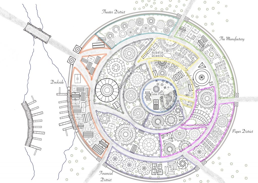 The Map of Cimenarum during the reigns of Vohan and Savrin the Usurper.
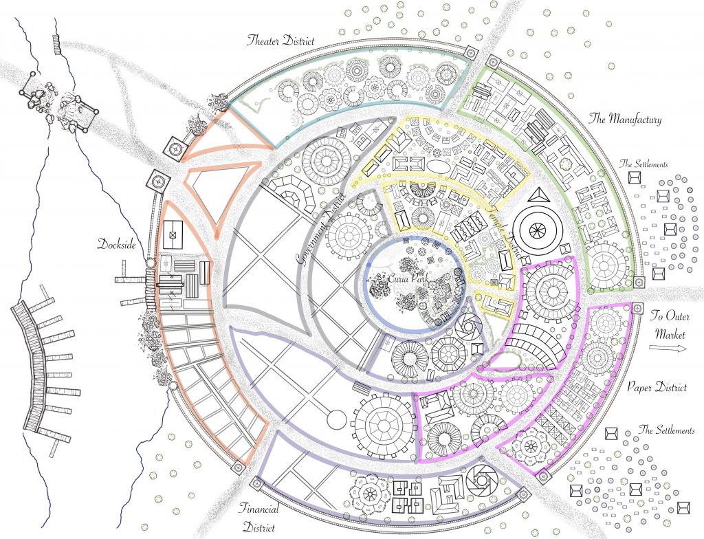 Cimenarum, after the fire.
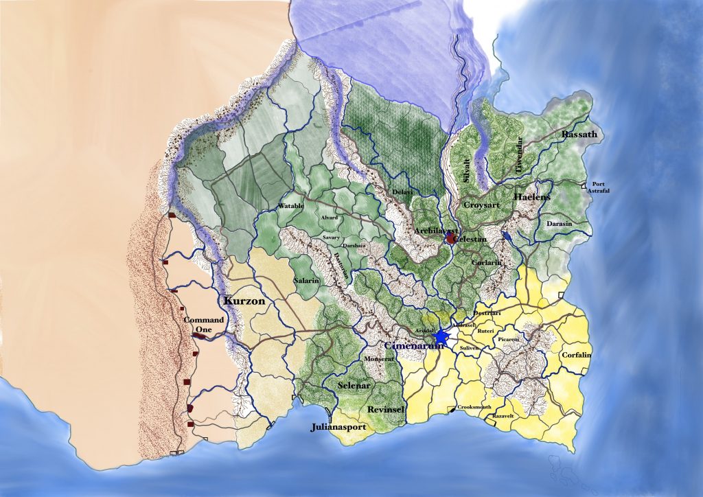 Map of Galantier.
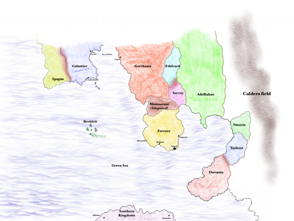 Galantier’s side of the world.